Geographical Diversity of India - Class 7 Social Science Chapter 1 Model Question Paper (PDF · 14 pages · Free download) Download the full PDF free
You are looking at pages 1 to 3 of 14. The full PDF is free to download.
The Himalayas cross six countries, so why is Afghanistan not part of the Indian Subcontinent? This free Geographical Diversity of India model question paper for CBSE Class 7 Social Science Chapter 1 opens with puzzles like that, and it is a 14-page chapter test based on the NCERT textbook Exploring Society: India and Beyond (Part 1), with a full marking scheme. It is an independent practice paper and not an official CBSE or NCERT publication.
The paper is set for 50 marks and 2 hours, the way a school would run a chapter-wise unit test. Most questions ask students to apply, compare and judge, not just recall, so it works as a final check after reading the chapter and revising from notes.
Class 7 Social Science Chapter 1 Model Question Paper: What Is Included
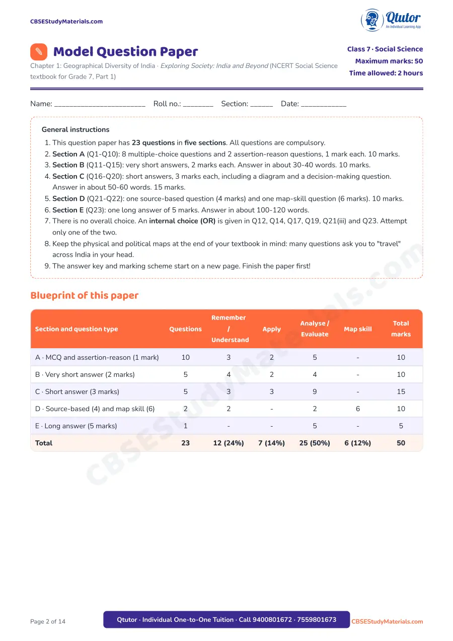
- A proper paper header with class, subject, chapter, maximum marks (50) and time (2 hours), plus a name and roll-number line
- Nine general instructions, written the way a school exam paper gives them
- A blueprint table that shows marks by question type and by thinking level (remember, apply, analyse/evaluate, map skill)
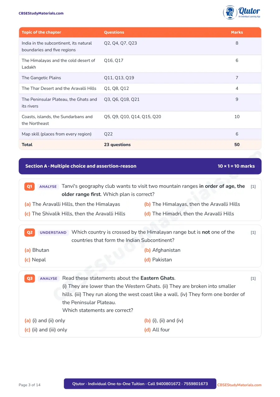
- A second blueprint table that shows which topics of the chapter carry how many marks
- 23 original questions in five sections, with internal choice (OR) in six questions
- A source-based question built on a travel diary from the forests of Chhattisgarh
- A side-view diagram of southern India, from the Arabian Sea to the Bay of Bengal, to label and interpret
- A map-skill question on an outline map of India showing the complete official boundary of India, with six lettered places to identify
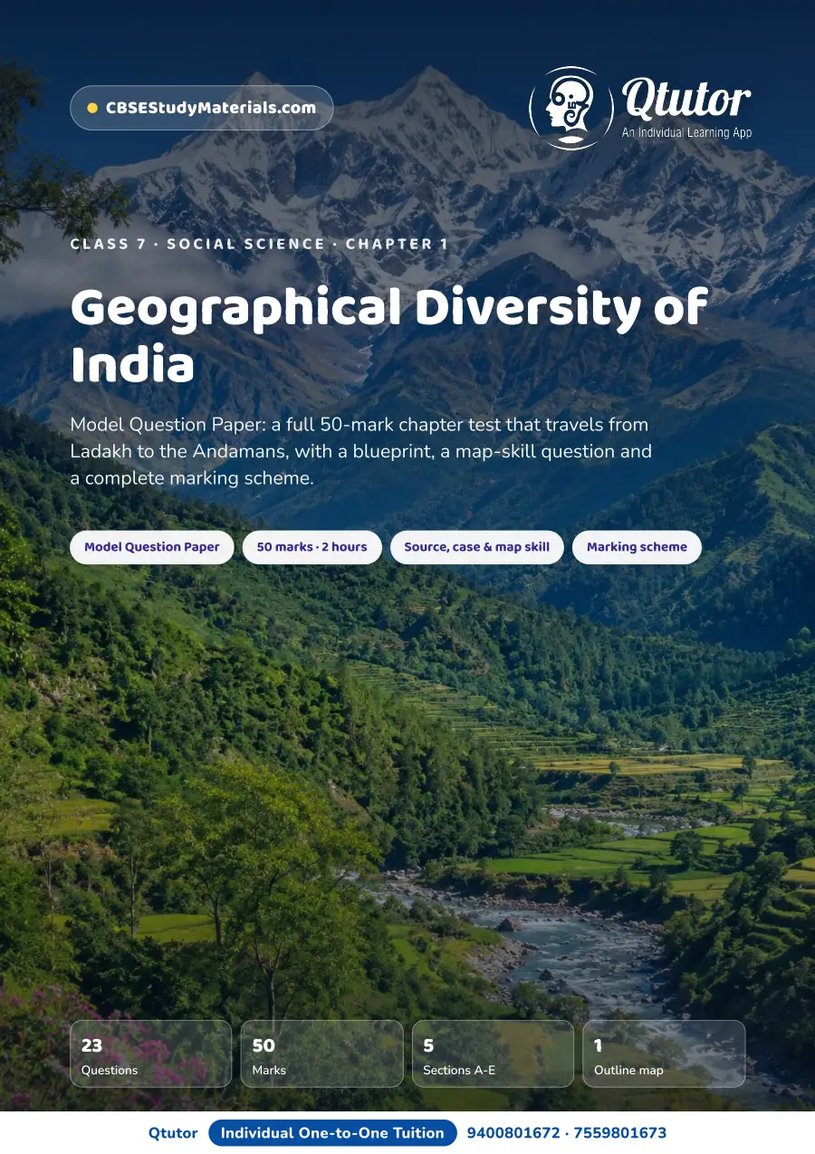
- Three photos: the Himalayas on the cover, and the Thar Desert dunes and the Kerala backwaters linked to questions
- A "My score card" table for self-assessment
- A complete answer key and marking scheme with value points and step marks
Structure of the Paper
| Section | Question type | Questions | Marks |
|---|---|---|---|
| A | MCQ (8) and assertion-reason (2) | Q1-Q10 | 10 |
| B | Very short answer, 2 marks each | Q11-Q15 | 10 |
| C | Short answer, 3 marks each (incl. diagram and decision-making) | Q16-Q20 | 15 |
| D | Source-based (4) and map skill (6) | Q21-Q22 | 10 |
| E | Long answer | Q23 | 5 |
| Total | 23 | 50 |
About half the marks (25 of 50) go to analyse and evaluate questions, 7 marks to application, 12 marks to remember-and-understand and 6 marks to map skill.
Geographical Diversity of India Class 7 Important Topics Covered
- India in the Indian Subcontinent, its natural boundaries and the five regions used to describe it
- The Himalayas: their ranges, the Great Himalayan National Park and its UNESCO World Heritage status
- Ladakh, the cold desert, compared with the hot Thar Desert
- The Gangetic Plains: water, fertile soil, transport networks and where people live
- The Thar Desert, sand dunes and the Aravalli Hills (minerals, Zawar's zinc, forts)
- The Peninsular Plateau, the Western and Eastern Ghats, the eastward tilt and its rivers
- Tribal communities of the plateau forests, waterfalls, hydroelectricity and coal
- The west and east coasts, deltas, Lakshadweep and the Andaman and Nicobar Islands, including Barren Island and the Cellular Jail
- The Sundarbans delta and the Meghalaya Plateau of the Northeast
Geographical Diversity of India Class 7 Important Questions (Sample)
Section A, Q7 (Apply, 1 mark). India's coastline is over 7500 km long, and the Himalayan range is about 2500 km long. The coastline is roughly ______ the length of the Himalayan range. Answer: three times, because 7500 ÷ 2500 = 3.
Section A, Q10 (Assertion-reason, 1 mark). Assertion: Lakshadweep lies in the Arabian Sea, close to the Malabar coast of Kerala. Reason: All the islands of Lakshadweep were formed by volcanoes. Answer: (c) A is true but R is false; Lakshadweep is made of coral, while the volcanic islands belong to the Andaman and Nicobar group.
Section C, Q20 (Evaluate, 3 marks). A company wants to build a new port. Site 1 is a creek on the west coast near Mumbai; Site 2 is inside the mangrove forests of the Sundarbans. Which site would you recommend, and why? The marking scheme gives one mark per reason, for example:
| Value point | Marks |
|---|---|
| The west coast has creeks, coves and estuaries | 1 |
| It has ports and cities that have been centres of trade for millennia | 1 |
| The Sundarbans are a UNESCO Heritage site and home of the Royal Bengal Tiger | 1 |
Section D, Q22 (Map skill, 6 marks). Students identify six lettered places (such as Pangong Tso, Gaumukh, Jog Falls and Barren Island) from a name bank, read the latitude marks to find which places lie south of 15°N, and link places to rivers and rainfall.
How This Model Question Paper Helps
- It gives a real exam feel: timed, sectioned, with marks shown against every question
- Questions are original and mostly indirect, so students must think with the chapter, not repeat lines from it
- The blueprint shows exactly how marks are spread across topics and thinking levels, which helps teachers and parents plan revision
- The marking scheme shows how marks are split (for example ½ + ½ or 1 + 1), so students learn what a full-mark answer needs
- The map question builds outline-map skills that are used again in later classes
Who Should Use It
- Class 7 students preparing for a unit test, periodic test or half-yearly exam on this chapter
- Teachers who want a ready chapter-wise test with a blueprint and marking scheme
- Parents who want to check a child's understanding at home in two hours
How to Download the Class 7 Geographical Diversity of India Model Question Paper PDF
The PDF is free. Use the download button below, print it, and attempt it in 2 hours before opening the answer key.
Geographical Diversity of India - Class 7 Social Science Chapter 1 Model Question Paper (PDF · 14 pages · Free download)
Related Resources
- Geographical Diversity of India Class 7 Notes: revision notes and chapter summary to read before the test
- Geographical Diversity of India Class 7 Worksheet: extra practice with two India maps and puzzles
- Geographical Diversity of India Class 7 Flash Cards: quick recall cards
- Class 7 Social Science Chapter 1 study material: all resources for this chapter
- Class 7 Social Science: all chapters of the subject
- Next chapter: Understanding the Weather
FAQs on Class 7 Social Science Chapter 1 Geographical Diversity of India
Where can I download the Class 7 Social Science Chapter 1 model question paper PDF? You can download it free from this page using the download button. It is a 14-page PDF with the question paper and the answer key.
Is the Geographical Diversity of India model question paper free? Yes, this model question paper is free to download, print and practise.
How many marks and how much time does the paper have? The paper is for 50 marks and 2 hours, with 23 questions in Sections A to E.
Does the model question paper include answers? Yes. A full answer key and marking scheme with value points and step marks starts on a new page after the questions.
Which book is Geographical Diversity of India Class 7 from? It is Chapter 1 of the NCERT Social Science textbook Exploring Society: India and Beyond for Grade 7, Part 1, used in CBSE 2026-27.
Is there a map question in the Class 7 Geographical Diversity of India paper? Yes. Q22 is a 6-mark map-skill question on an outline map of India with six places to identify, plus questions on latitude, rivers and rainfall.
What are the important questions in Geographical Diversity of India Class 7? Expect questions on the Himalayan ranges, cold and hot deserts, the Gangetic Plains, the tilt of the Peninsular Plateau, coasts and islands, and map work. This paper covers all of these with internal choice.
Study tip: attempt the full paper in one sitting, then mark it yourself with the scheme and revise only the questions you lost marks on.