Oceans and Continents - Class 6 Social Science Chapter 2 Notes with World Maps (PDF · 18 pages · ₹49) Unlock the full PDF for ₹49
Free sample: pages 1 to 3 of 18. The full PDF costs ₹49.
Spin a globe and one colour wins every time: blue. These Class 6 Social Science Chapter 2 Oceans and Continents notes start from that simple observation and explain why almost three-fourths of our planet is water, why the Northern Hemisphere holds more land, and why your friend who counts six continents is not wrong.
This is an 18-page premium chapter notes PDF (₹49) for CBSE Class 6 Social Science, NCERT Exploring Society: India and Beyond, Chapter 2 "Oceans and Continents", written for CBSE 2026-27 students. It is NCERT based study material prepared independently; it is not an official CBSE or NCERT publication. A friendly guide called Neel (his name means "blue") walks you through every topic with original world maps, diagrams, photos and a "Check yourself" quiz with answers.
Class 6 Social Science Chapter 2 Oceans and Continents Notes: What Is Included
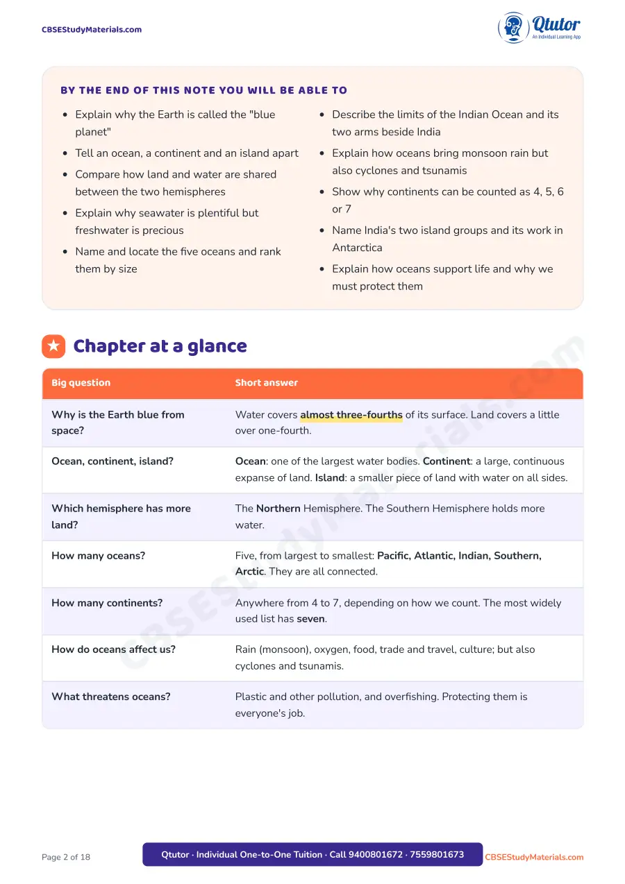
- A "Chapter at a glance" table that answers the chapter's big questions in one line each
- Ten numbered topic sections with definition, big-idea, common-mistake, think-deeper, did-you-know, real-life and "try this" cards
- An original colour world map of the five oceans and seven continents, with the Equator and the conventional ocean boundaries marked
- Two "pole view" maps of the Earth seen from above the North Pole and the South Pole, to compare land and water in the two hemispheres
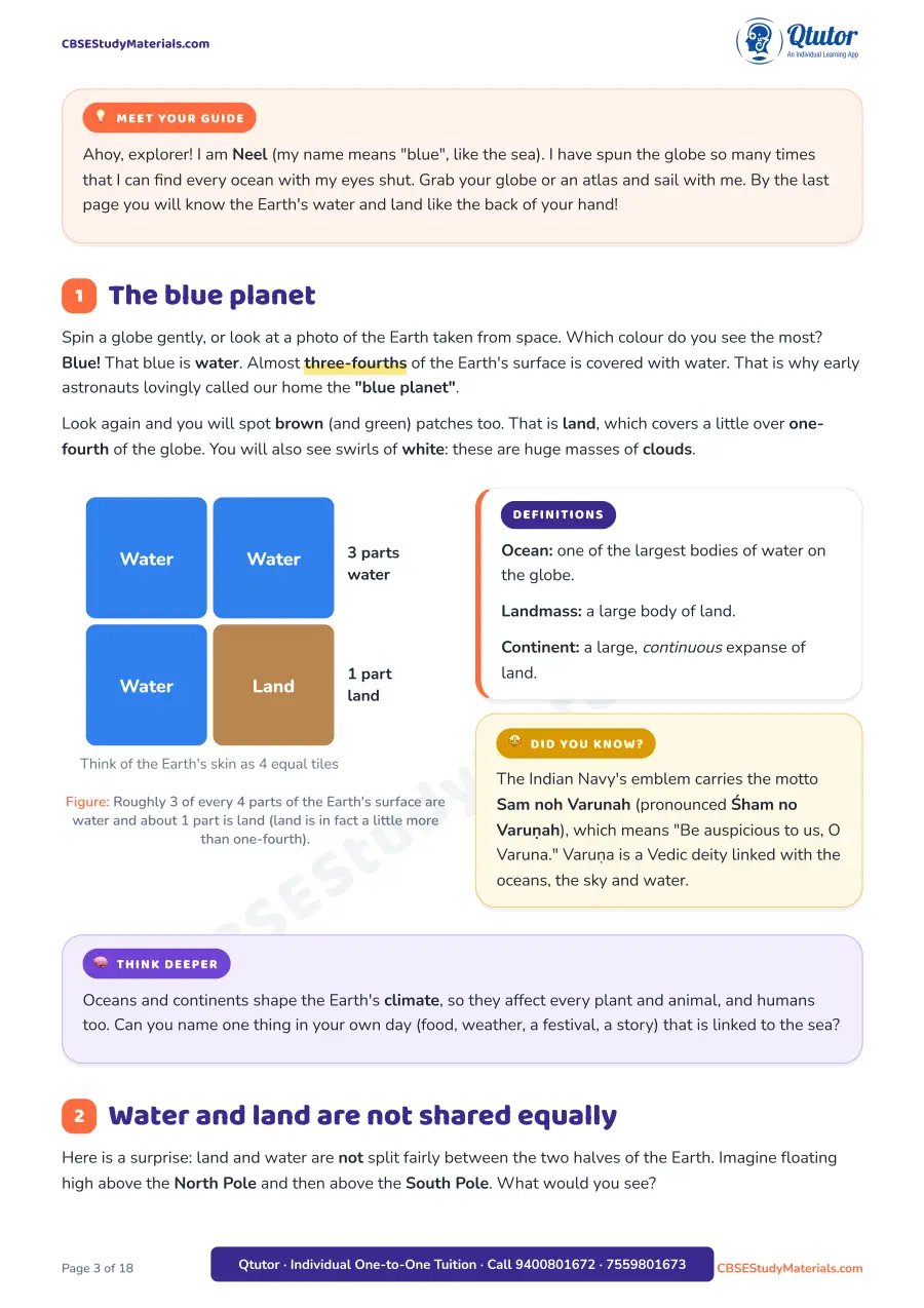
- More original diagrams: water vs land tiles, salty water vs freshwater stores, the ocean size staircase, a box diagram of the Indian Ocean's neighbours, a tsunami cross-section, a 7-to-4 continent counting chart, a square-count chart of continent sizes, a continent-vs-island sketch with India's two island groups, and an "ocean's gifts" web
- Three photos: waves on a rocky coast, a classroom globe turned to the Pacific, and a tropical island with a coral reef
- A hemisphere table for all five oceans, an Antarctica timeline, a 12-term key-terms grid, a mind map and a ten-point chapter summary
- 12 "Check yourself" important questions (MCQ, map labelling, case, data, odd-one-out, sequence and HOTS) with a compact answer key
Structure of the PDF
| Part | What you will find | Pages (approx.) |
|---|---|---|
| Cover, objectives, chapter at a glance | Ten learning goals and a seven-row summary table | 1–2 |
| The blue planet and the hemispheres | Sections 1–2: three-fourths water, pole-view maps | 3–4 |
| Water and the five oceans | Sections 3–4: freshwater, world map, ranking, hemisphere table, marine life | 4–7 |
| India and the Indian Ocean, disasters | Sections 5–6: Arabian Sea, Bay of Bengal, monsoon, cyclones, the 2004 tsunami | 8–9 |
| Continents and islands | Sections 7–8: counting 4 to 7 continents, size chart, Greenland, India's islands | 9–12 |
| Antarctica and oceans and life | Sections 9–10: Dakshin Gangotri, planet's lungs, threats | 12–14 |
| Revision | Key terms, mind map, quick recap | 14–15 |
| Practice | 12 questions and answer key | 16–18 |
Oceans and Continents Class 6 Important Topics
- The blue planet: water covers almost three-fourths of the Earth's surface; land a little over one-fourth
- Ocean, landmass, continent and island: clear definitions and the difference between them
- Unequal sharing: the Northern Hemisphere has more land; the Southern Hemisphere is mostly water
- Seawater and freshwater: most water is salty; freshwater in glaciers, rivers, lakes, the atmosphere and groundwater is a tiny share, so it must be saved
- The five oceans: Pacific, Atlantic, Indian, Southern and Arctic, largest to smallest, all connected; seas, bays and gulfs; marine flora and fauna
- India and the Indian Ocean: Asia to the north, Africa to the west, Australia to the east, the Southern Ocean to the south; the Arabian Sea and the Bay of Bengal
- Oceans and disasters: monsoon rain, cyclones, tsunamis, the 26 December 2004 tsunami, early warning systems and the National Disaster Management Authority
- Counting continents: why the count can be 4, 5, 6 or 7, Eurasia, the Olympic rings, and the size order from Asia to Australia
- Islands: Greenland as the largest island, India's 1,300+ islands, Andaman and Nicobar and Lakshadweep
- India in Antarctica: the programme since 1981 and Dakshin Gangotri (1983)
- Oceans and life: rain, more than half the world's oxygen, food, trade, culture, World Oceans Day (8 June), plastic pollution and overfishing
Oceans and Continents Class 6 Important Questions (Sample)
Counting continents (Section 7):
| Count | Continents |
|---|---|
| Seven | Africa, Antarctica, Asia, Australia, Europe, North America, South America |
| Six | Europe and Asia joined as Eurasia |
| Five | also North and South America joined as America |
| Four | also Africa and Eurasia joined as Africa-Eurasia |
Check yourself, Q2 (Apply): A ship leaves Mumbai and keeps sailing due south until it nears Antarctica. In which order does it pass through the waters? (Answer in the key: Arabian Sea, then Indian Ocean, then Southern Ocean.)
Check yourself, Q10 (Data): Using the square chart, if Europe (5 squares) and Asia (22 squares) are joined as Eurasia, is it more or less than twice Africa (15 squares)? The key works it out: 22 + 5 = 27 and 2 × 15 = 30, so Eurasia is a little less than twice Africa.
How the Oceans and Continents Notes Help
- Turn the chapter into a story you can picture, with maps placed exactly where each idea is explained
- Clear up common mistakes, such as thinking the Bay of Bengal is a separate ocean or that Australia is an island
- Give quick revision before a class test through the chapter summary, mind map and key terms
- Build map skills with a blank numbered world map to label in the practice set
- Practise the indirect, application-style questions that the new NCERT book encourages
Who Should Use It
- Class 6 students studying the new NCERT Social Science book Exploring Society: India and Beyond
- Parents who want simple, accurate revision notes to go through the chapter with their child
How to Download the Class 6 Oceans and Continents Notes PDF
This is a premium PDF priced at ₹49. Use the button below to get the full 18-page PDF download.
Oceans and Continents - Class 6 Social Science Chapter 2 Notes with World Maps (PDF · 18 pages · ₹49)
Related Resources
- Class 6 Social Science Chapter 2 Oceans and Continents: chapter page
- All Class 6 Social Science study material
- Oceans and Continents notes and application questions (our other Chapter 2 PDF)
- Chapter 1 Locating Places on the Earth notes
- Chapter 1 Locating Places on the Earth worksheet
- Chapter 1 Locating Places on the Earth flash cards
- Chapter 1 Locating Places on the Earth model question paper
FAQs on Class 6 Social Science Chapter 2 Oceans and Continents
Where can I download Class 6 Social Science Chapter 2 Oceans and Continents notes PDF? You can download it from this page using the download button. It is an 18-page PDF with maps, diagrams, a mind map and practice questions with answers.
What is the price of the Oceans and Continents Class 6 notes PDF? It is a premium PDF priced at ₹49, with original world maps, 12 practice questions and a full answer key.
What are the important topics in Oceans and Continents Class 6? The blue planet, land and water in the two hemispheres, freshwater, the five oceans, the Indian Ocean, monsoon, cyclones and tsunamis, counting continents, islands, India in Antarctica, and how oceans support life.
How many continents and oceans are there according to Class 6 Chapter 2? There are five oceans: Pacific, Atlantic, Indian, Southern and Arctic. Continents can be counted as four, five, six or seven, but the seven-continent list is the one most widely used.
Which book is Oceans and Continents Class 6 from? It is Chapter 2 of the NCERT Class 6 Social Science textbook Exploring Society: India and Beyond, in the theme "India and the World: Land and the People".
Are important questions for Oceans and Continents Class 6 included? Yes. The "Check yourself" set has 12 important questions, including a blank map to label, a tsunami case study, data and sequencing questions, with a compact answer key.
Study tip: keep a globe or the world map from these notes open while you revise, and name each ocean and continent aloud as you point to it.